Hello! We’re Freegrow
“Can I customize the map with your API?”,
“Can we export place data as a list for our app?”
We get these kinds of questions a lot.
At Freegrow, we develop our own Map Creation API.
It’s packed with features for managing and using spatial data — from project-based place management to location-based interaction and visualization tools.
In this API series, we’ll walk you through what’s possible with our API — and how to use it.
Let’s start with the basics: How to get a list of all places registered in a project.
View All Places in a Project
With the GROWSPACE API, you can easily fetch a list of all places under a specific project.
“Which places are registered in my project?”,
“Can I link them using unique IDs?”This API helps you do exactly that.
How to Use the API
Using the GROWSPACE API is simple.
Just provide a Project ID, and you’ll get a list of all registered places in that project.
Each place has a unique identifier called placeAreaUid. This UID is used as a primary key when connecting with other APIs.
You’ll need this UID before doing things like:
- Viewing visitor stats for a place
- Getting content linked to a place
- Updating place details
Example API Response :
[
  {
    "id": 1,
    "placeAreaUid": "A01",
    "name": "Place 1",
    "description": "description",
    "createDate": "2025-07-16 10:49:44",
    "updateDate": "2025-07-16"
  },
  {
    "id": 2,
    "placeAreaUid": "A02",
    "name": "Place 2",
    "description": "description",
    "createDate": "2025-07-16 10:49:52",
    "updateDate": "2025-07-16"
  }
]
※ This response shows the Place UID, name, description, and timestamps — all in JSON format.
Example: Displaying the Place List in Your App
What you do with the API response is up to you.
At Growspace, we use it to display a list of places in the UI — like this:
- When a user selects a project, related places appear automatically.
- The system fetches Place UID, name, description, and dates through the API.
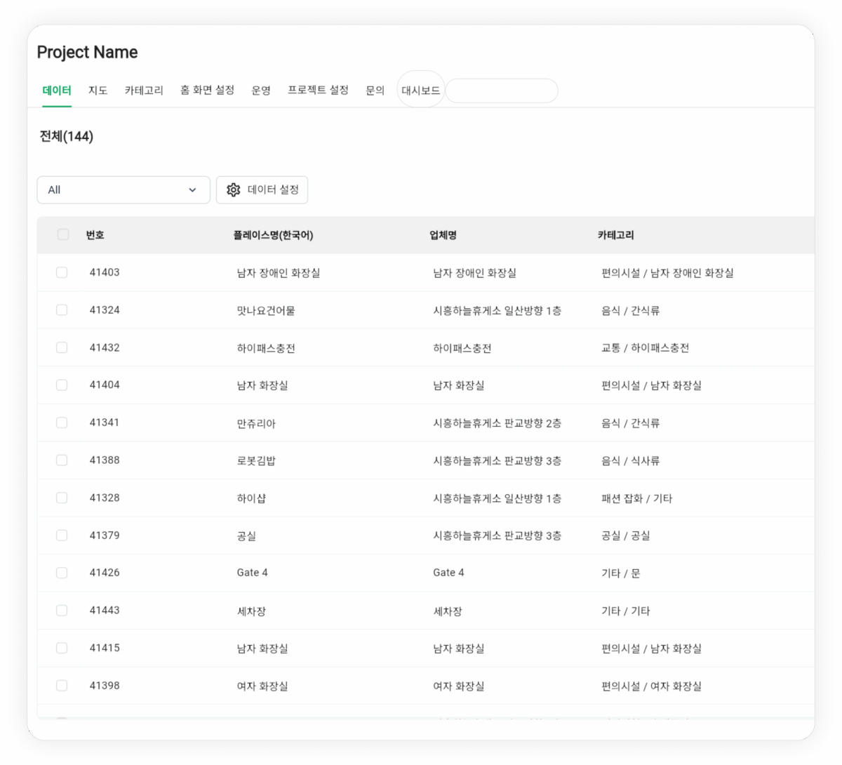
Even though it’s just a list, it’s the foundation for powerful features like:
- Pop-ups with detailed place info
- Indicators for linked content
- Visitor path tracking using UIDs
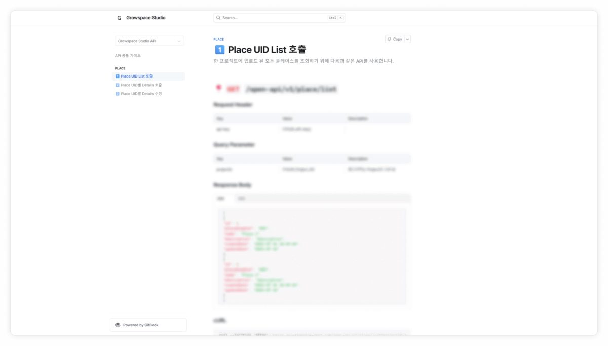
Where to Access the API
You can find more details in the test version of our API documentation (link in the comments).
It covers:
- How to get your API key
- How to use the API
- What the response structure looks like
Need help issuing your key or testing the integration? Feel free to contact us — we’ll be happy to assist!
What’s Next?
In our next post, we’ll show you how to use the Place UID to get more detailed info.
You’ll be able to:
- Check what content is linked to each place
- See coordinates and tags
- Update place info directly
Map APIs can seem complex —
But we’ve designed ours to be simple, useful, and ready to go.
We hope this series helps you get more from your location data.
See you in the next post! 👋