In this guide, we’ll introduce how to set up indoor maps (floor plans) in the GrowSpace UWB system.
We’ll guide you step by step to ensure that the tag’s location updates in real-time on your map as it moves.
Why Set Up a Map?
The UWB system measures tag positions as numerical coordinates (X, Y, Z).
However, it’s difficult to intuitively visualize spatial locations with numeric values alone.
Benefits of map setup:
- Match indoor floor plans to real-world coordinates
- Real-time position updates as tags move
- Analyze paths and detect entry into specific areas
Uploading a Floor Plan Image
First, you need to upload a floor plan of your indoor space to the system.
Supported image formats: JPG, PNG
Recommended floor plan files: structural diagrams including walls, doors, and key areas
Upload method:
- Launch the GrowSpace Development Software (UWB configuration software)
- Go to [Map Settings] menu → Click the [Image Upload] button
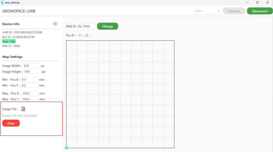
3. Select the floor plan file → Verify it displays correctly
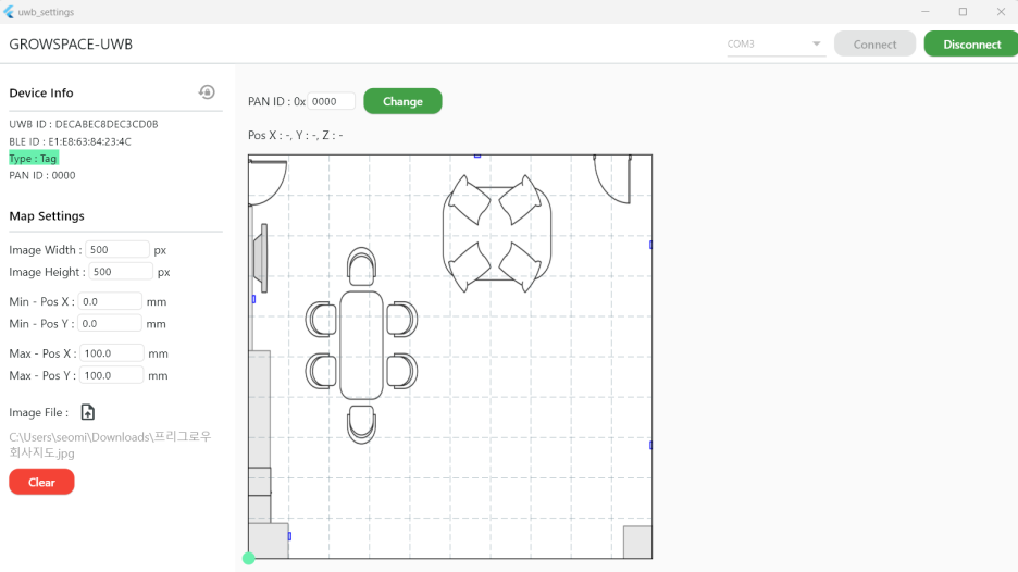
Coordinate Settings – Aligning Map and Real Space
For accurate alignment of the map and actual space, you must set precise coordinate ratios.
Use anchor coordinates from previous steps to achieve better matching accuracy.
✅ How to configure
- Measure your indoor space (e.g., width 20m, height 15m)
- Set MIN & MAX coordinates
- MIN Coordinates: Starting point of the map (e.g., bottom-left)
- MAX Coordinates: Endpoint of the map (e.g., top-right)
- Coordinate units: Enter values in millimeters (mm)
Example coordinate entry:
MIN X, MIN Y = (0, 0)
MAX X, MAX Y = (20000, 15000)
Click [Save] to apply your settings
💡 TIP:
- The floor plan’s size and ratio must match actual dimensions.
- All coordinate inputs must be in mm units.
- Perform tests to ensure location data accurately reflects on your map.
Adjusting Map Size (Ratio)
Ensure the floor plan matches the actual space proportions.
If the ratio differs, location data may become distorted.
How to adjust:
- Check and adjust the pixel resolution of the map image
- Ensure the map fully represents the actual indoor space
- Enter X, Y, Z coordinates accurately for proper alignment
Verifying Your Map Setup
After setting up your map, verify its functionality.
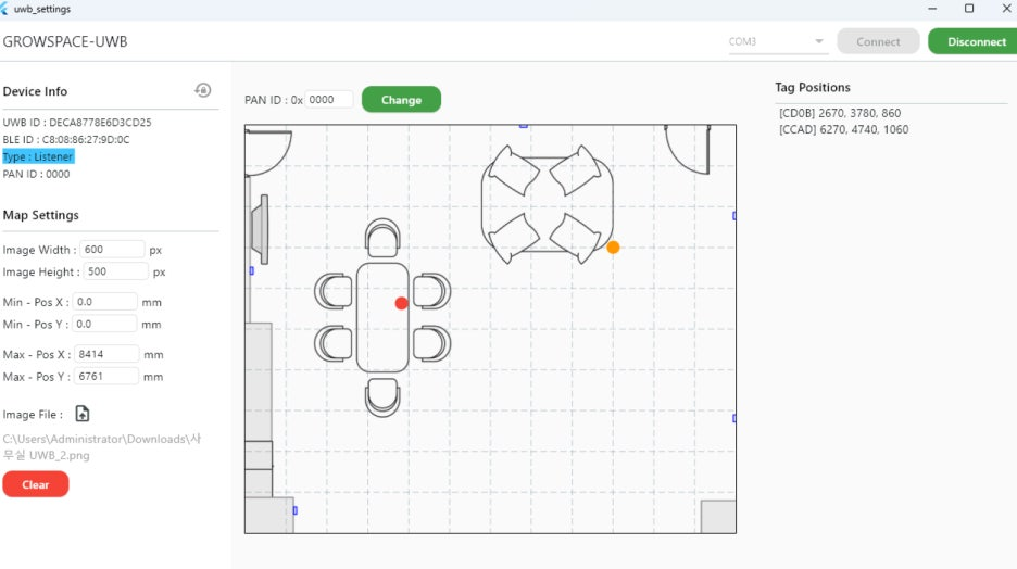
✅ Testing method
- Move the tag and check if its location updates in real-time on the map
- If location errors occur, recheck coordinate settings
- Monitor real-time data logs to confirm correct tag operation
After map setup?
You can now analyze tag movements in real-time!
Utilize path analysis, movement patterns, and zone-entry detection features.
Why Listener USB Connection Must Remain Active
The Listener collects tag data and transmits it directly to your PC.
Keeping the USB connection active ensures immediate updates of real-time data.
Why maintain USB connection?
- Real-time monitoring – Check if tags are accurately displayed
- Optimized development environment – Reliable data collection for research and testing
- Troubleshooting & debugging – Immediate problem-solving when data issues arise
🎉 Setup Complete! Real-time Location Tracking Activated!
Tag, Listener, and map setups are now fully complete.
You can now monitor tag positions in real-time as they move within your indoor space!