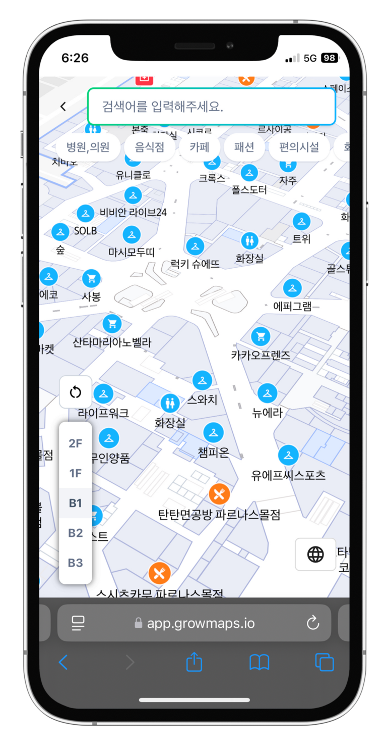
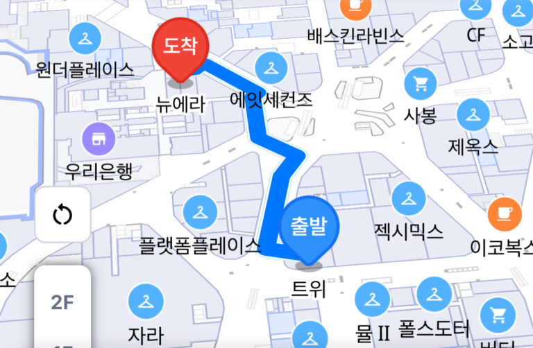
Our advanced Real-Time Location System (RTLS) technology enables real-time tracking of people and assets within a space.
By flexibly integrating UWB (Ultra-Wideband), RFID, and Wi-Fi Fingerprinting, we provide the optimal positioning solution tailored to various environments.
UWB technology utilizes ultra-short nanosecond (ns) transmission times, achieving high-precision indoor positioning with an accuracy of within 30 cm, comparable to GPS. It maintains high accuracy even in environments with walls and obstacles, making it ideal for manufacturing plants, logistics warehouses, hospitals, and smart buildings.
Magnetic fingerprinting is a positioning technology that analyzes the unique magnetic fields of buildings and indoor spaces. Unlike Wi-Fi or Bluetooth signals, it does not require external signals, making it fast, efficient, and cost-effective for indoor navigation in shopping malls, airports, museums, and subway stations.
By using RFID tags and BLE beacons, entry and exit records can be accurately tracked within specific zones. This allows for automated access control and asset tracking. It is widely used in large-scale logistics facilities, smart offices, and exhibitions, providing a cost-effective and efficient indoor positioning solution.
The GrowSpace RTLS system goes beyond simple location tracking by using AI-powered movement analysis to optimize routes and maximize space utilization. For example, it can automatically analyze high-traffic areas to provide optimal navigation paths or improve logistics flow based on real-time asset movement data.
Design complex spaces in a simple and intuitive way. Anyone can easily create indoor maps using templates and shape-based tools.
Share generated maps through a URL to access them on both web and mobile platforms. Users can view and use maps conveniently without installing additional apps.
With built-in tools and templates, anyone can create maps effortlessly. Complex spaces can be designed with simple clicks and drags, and frequently used structures can be saved as templates for maximum efficiency.
Provide users with the best routes using precise location data. Users can navigate easily and quickly to their destinations, even indoors.
Manage space information in real-time through a web-based platform that also allows seamless communication with users.
Easily integrate spatial data through APIs. Developer-friendly documentation and sample codes make implementation simple.
Analyze user activities and spatial data to create custom reports and dashboards.
Ensures secure data protection through encrypted communication and authentication systems.
Clear developer guides and sample codes enable quick and easy implementation.
Provides standardized data integration across different platforms and programming languages.
Offers real-time spatial and location data for immediate response and data utilization.
Supports multiple formats like JSON, XML, and CSV for maximum compatibility with other platforms and applications.