The Smartest Choice for Smarter Spaces – GrowSpace
In this post, we introduce GrowSpace’s indoor navigation technology, which allows visitors to easily find their way from Youngpoong Bookstore to Starfield Library inside COEX.
Due to the vast size of COEX, many visitors find it challenging to navigate, especially first-time visitors.
But don’t worry!
GrowSpace’s indoor navigation provides fast and accurate directions to your desired destination, even in the complex layout of COEX.
Today, we’ll explore how this innovative technology works and how it enhances your visiting experience.
😊
What is Indoor Navigation?
GrowSpace Indoor Navigation: Setting a New Standard for COEX Navigation! GrowSpace utilizes geomagnetic positioning technology to accurately guide users, even in indoor spaces where GPS does not work well.
By using a smartphone, visitors can instantly determine their location, with Youngpoong Bookstore as a starting point for accurate navigation.
Even in the complex layout of COEX, the system provides the fastest and most efficient route in real time.
If you deviate from the suggested path or if circumstances change, the navigation system automatically recalculates and updates the route, eliminating the worry of getting lost.
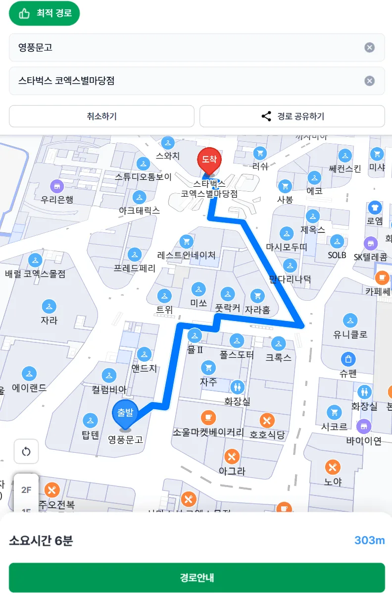
Traditional GrowSpace maps only display a static line between the start and destination, offering limited guidance based on manually input locations.
This system lacked the ability to provide real-time route guidance or dynamically update the suggested path based on changing conditions.
Smarter and Easier Navigation with GrowSpace Indoor Mapping
Unlike conventional maps, GrowSpace integrates geomagnetic positioning with a multi-sensor fusion algorithm to provide a smarter and more precise indoor navigation experience.
The system maps indoor environments by collecting sensor data from smartphones and combines geomagnetic fields, BLE, WiFi, PDR, barometer, and GPS for accurate positioning.
This fusion algorithm allows the system to function accurately without requiring additional hardware installations.
Thanks to this innovation, GrowSpace provides seamless real-time navigation and precise location tracking, overcoming the limitations of traditional maps.
As demonstrated in the video, GrowSpace precisely tracks and updates the user’s real-time location on the map.
This intuitive technology is designed for easy user adoption.
GrowSpace’s real-time location tracking service ensures that users can follow their guided path accurately without the risk of getting lost.
This advanced solution allows seamless movement through complex environments, proving its value as a smart navigation tool.
With GrowSpace, navigating through large venues is no longer a challenge—it becomes an easy and intuitive experience.
😊
If you have any questions or want to learn more about our solutions, feel free to reach out.
FREEGROW is always ready to make your spaces smarter and more efficient, providing expert consultation and rapid support to deliver the best smart mapping services.
Frequently Asked Questions
Do visitors need to download an app to use this?
No — GrowSpace’s indoor navigation runs in a mobile browser via a QR code or link, so there’s nothing to install.
Does this only work for COEX?
No — the same underlying map platform is used across a range of large indoor venues; COEX is simply one example covered in this post.
For a broader look at the mapping technology itself, see our companion piece on the latest mapping technology at COEX.
Learn more on GrowSpace’s map-based exhibition service page.
PLANNING A DEPLOYMENT?
Which setup fits your site?
GrowSpace designs real-time location tracking (RTLS) around the conditions of your factory, warehouse or construction site — installation, integration with existing systems and ongoing operation handled by one team.